Climate Risk Early Warning Systems and GK2A Satellite
In recent years, the frequency and severity of natural disasters and climate change impacts have gradually increased. Moreover, these events are also becoming increasingly difficult to predict. Therefore, it is essential to master and improve technologies, including natural disaster risk forecasting technologies, to reduce the damage caused by natural disasters. One of the most prominent applications of advanced technology is the early warning system for natural disasters.
The GK2A satellite is a geosynchronous-orbiting Earth observation satellite, considered to be one of the most advanced meteorological geostationary satellite technologies in use today for early warning systems, especially in Southeast Asia and the Pacific areas. The practical applications of the GK2A are highlighted by its usefulness in early warning systems for natural disasters, as well as the economic, financial, and social value it brings.
Socioeconomic Impacts of the GK2A
Integrated and continuously improved using the most advanced technologies, the GK2A meteorological satellite data is considered a valuable resource for early warning systems. Due to the orbital path of this satellite over the Earth’s surface, the areas observed by this satellite are Southeast Asia and the Pacific, which are regions that are heavily affected by natural disasters and the impacts of climate change. The features of this satellite are based on observing, calculating, and evaluating cloud patterns by observing through images, temperature, pressure, and other data to arrive at conclusions about what phenomena may occur. Using high-resolution cloud observation images (0.5 km – 1 km for VIS and 2 km for infrared channels), as well as data updates every 10 minutes, the GK2A satellite is used to detect various natural disaster risks including floods, storms, heat waves, droughts, earthquakes, tsunami, and so on. Through this, the GK2A plays an important role in the early warning systems for countries in the region that the satellite can observe.
In addition to the useful and outstanding application of the GK2A satellite in early warning systems for natural disasters in near real-time and real-time, data collected from this satellite is also used to provide weather and climate-related solutions for businesses. These businesses produce products or services that are easily affected by natural disasters and climate change, such as the mining industry, the marine industry, the insurance industry, and the agricultural industry. The cost of production, the level of risk, and many other factors related to revenue and the survival of businesses operating in these industries depend heavily on natural and environmental factors. For example, the coffee farming industry is highly affected due to high sensitivity to weather factors changes such as temperature, moisture, sunlight, and even air quality. Another example is the coal mining industry, which is also greatly affected by factors related to rainfall, floods, gusts, thunderstorms, etc. By collecting data related to each industry, such as production, environmental and natural factors in the past, as well as climate data from the satellite collected at present for any region, combined with algorithms and climate forecasting software, products can be produced to help businesses pinpoint production and business areas more accurately. For example, in the coffee farming industry mentioned above, through processing climate data for a specific cultivation area in the past and present using data processing programs and future climate prediction algorithms, we can create tailored climate map products, providing data and illustrations according to customers’ requirements. Another example is the application of this climate data in the insurance industry. The goal is to help insurance firms understand how often and how severe floods, fires, heat waves, and other climate-driven disasters will be in the future so that they can adjust their businesses to cope with risks.
The reduction of damage caused by natural disasters or climate change to humans, infrastructure, and businesses that are affected by data from the GK2A satellite is recorded and reported with significant numbers. To analyze the costs and benefits of the GK2A satellite for South Korea, professors and researchers at Ewha Womens University and Seoul National University conducted an in-depth study and came up with promising results. Specifically, setting the standard measure by the costs incurred from 2011-2029 and the benefits achieved from 2020-2029 (the time after the launch of GK2A into space), and taking the 4.5% discount rate, the NPV was obtained at around 69.5 billion won, and the cost-to-benefit ratio was 1.12. These are just the results that the authors obtained from government centers and agencies. In fact, South Korea has been and is currently implementing many systems that can be applied to private businesses using the applications of this satellite, so the results achieved are certainly much more than expected.
With the above results, in the near future, it is hoped that the humanitarian and economic impact of the GK2A will be applied and developed more in developing countries that are suffering from the damage caused by natural disasters. Civilization and businesses in developing countries that are vulnerable to climate disasters and climate change now can reduce the stress from financial risks and environmental risks and increase self-protection by the significant and effective support of the GK2A satellite.
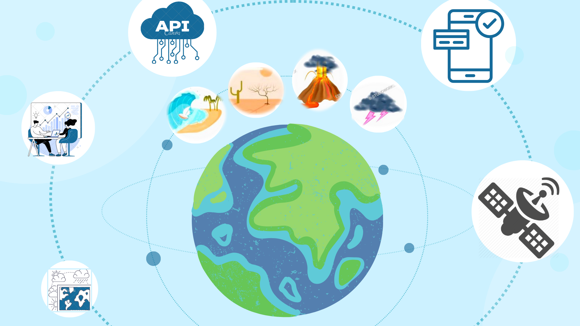
Illustration: The applications of the GK2A meteorological geostationary satellite in mitigating impacts of natural disasters.
About RainbirdGEO
RainbirdGEO is proud to be one of the first companies in Korea to be licensed to use data from the GK2A climate satellite from the Korea Meteorological Administration (KMA). Our team of experts has years of experience working with NGOs, government agencies, and the private sector. We use advanced technologies to develop and deliver accurate and timely early warning systems that are tailored to the specific needs of our clients. Our products and services include:
- Regional early warning systems that can be customized to meet the needs of specific communities or regions
- Regional climate maps that provide information on climate trends and patterns
- Climate-related solutions consulting services for businesses
- Climate API/FTP data analysis
We are committed to providing high-accuracy and timely early warning and predicting services that help to reduce the impact of natural disasters. We also believe that it is important to support communities that are most at risk from natural disasters and climate change.
Contact us at support@rainbirdgeo.com or
Learn more at https://rainbirdgeo.com/